
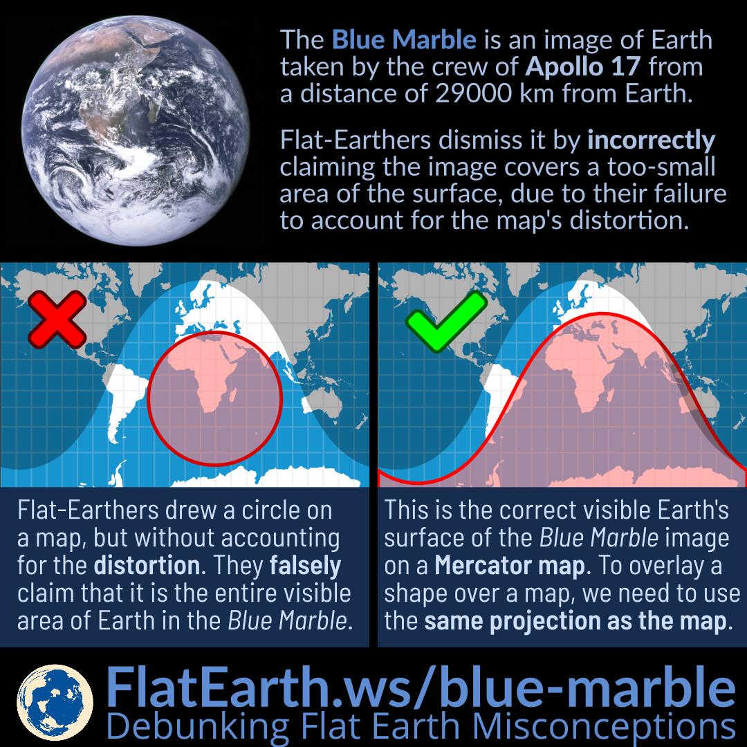
The Blue Marble is an image of Earth taken by the crew of the Apollo 17 spacecraft on its way to the Moon. It was taken from a distance of 29000 km from Earth’s surface.
Flat-Earthers dismiss it by incorrectly asserting that the image covers a too-small area of Earth’s surface, due to their failure to account for the maps’ distortion.
In an attempt to show the surface area covered by the Blue Marble, flat-Earthers drew a circle directly on a map, but without accounting for the distortion used by the map. Then, they falsely claim that it is the entire visible area of Earth in the Blue Marble image. Because the circle is far too small compared to the rest of the area not covered by the circle, they claim the Blue Marble image was somehow faked.
In reality, they failed to account for the distortion introduced by the projection used by the map. A circular area in the real world will not necessarily appear as a circle after the translation using the projection the map uses.
References
- The Blue Marble – Wikipedia
- Mercator projection – Wikipedia
- How to calculate the visible fraction of the Earth [e.g. 1972 Blue Marble, Apollo 17] – Metabunk