Gleason Map

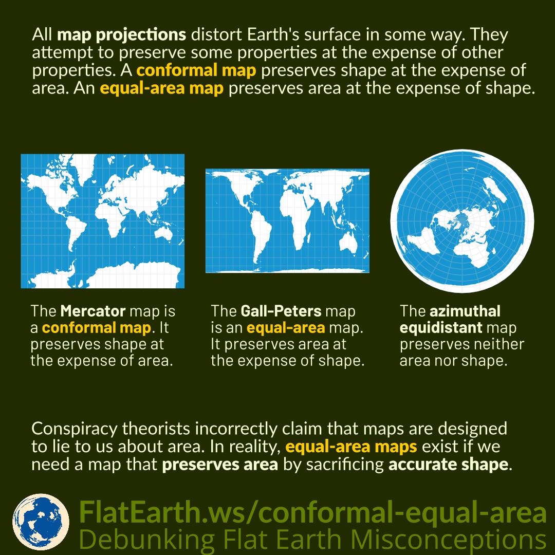
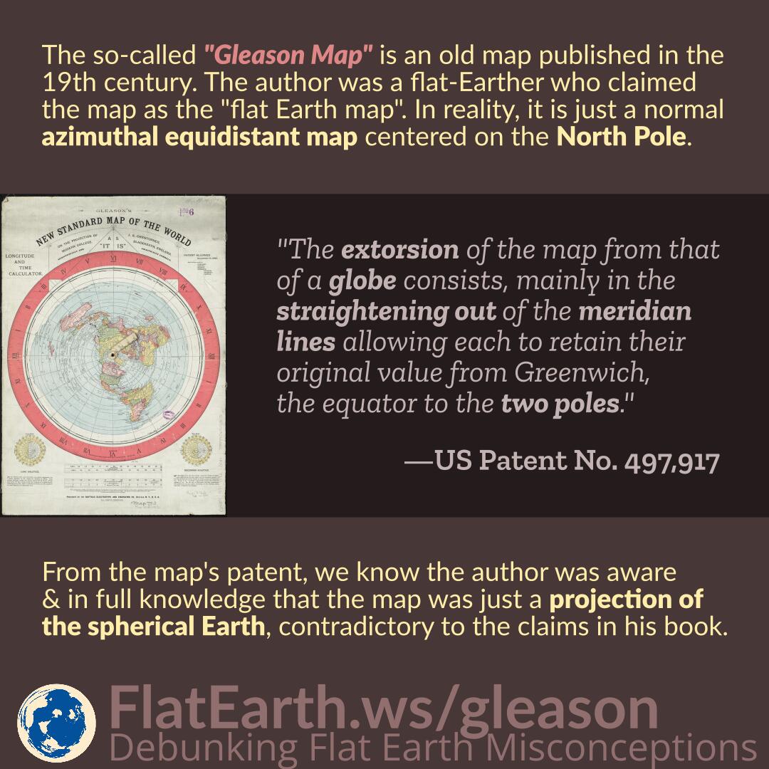
The so-called “Gleason Map” is an old map published in the 19th century. The author was a flat-Earther who claimed the map as the “flat Earth map.” In reality, the map is just a normal azimuthal equidistant map centered on the North Pole.

From the map’s patent, we know the author was aware and in full knowledge that the map was just a projection of the spherical Earth, contradictory to the claims in his book.

Continue reading “Gleason Map”

Conformal vs Equal-Area Map

All map projections distort Earth’s surface in some way. They attempt to preserve some properties at the expense of other properties. A conformal map preserves shape at the expense of area. On the other hand, an equal-area map preserves area at the expense of shape.

Conspiracy theorists incorrectly claim that maps are designed to lie to us about the real area of countries. In reality, equal-area maps exist if we need a map that preserves area by sacrificing accurate shape.

Continue reading “Conformal vs Equal-Area Map”

Distortion of Antarctica on Maps

Featured Video Play Icon

Antarctica is the fifth-largest continent, but on a Mercator map, it can appear larger than all the other continents combined due to the map’s distortion characteristic.

Flat-Earthers regard such “size discrepancy” as a failure of science to describe the world. In reality, map distortion also causes Antarctica’s huge size compared to other continents in the azimuthal equidistant map which they falsely claim as the so-called “flat-Earth map”.

Continue reading “Distortion of Antarctica on Maps”

Blue Marble and the Visible Area of Earth’s Surface

The Blue Marble is an image of Earth taken by the crew of the Apollo 17 spacecraft on its way to the Moon. It was taken from a distance of 29000 km from Earth’s surface.

Flat-Earthers dismiss it by incorrectly asserting that the image covers a too-small area of Earth’s surface, due to their failure to account for the maps’ distortion.

Continue reading “Blue Marble and the Visible Area of Earth’s Surface”

Distortion of Greenland on Maps

Featured Video Play Icon

Greenland is 1/14th the size of Africa. However, in a map with the Mercator projection, it appears the same size due to the distortion characteristics of the Mercator projection.

Flat-Earthers claim the distortion of the Mercator map is a failure of science to describe the world. In reality, distortion is a consequence of flattening a 3D shape into flat 2D media. Distortion also occurs with the azimuthal equidistant map, which is claimed by flat-Earthers as the so-called “flat-Earth map.” All maps have distortions: it is incorrect to assume the azimuthal equidistant map is distortion-free.

Continue reading “Distortion of Greenland on Maps”