Authagraph Map Projection

Featured Video Play Icon

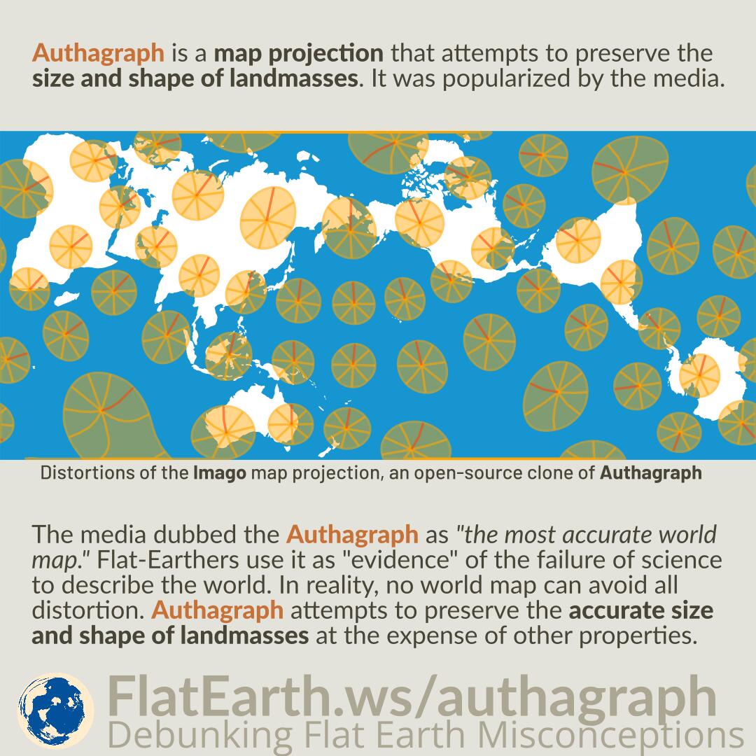
Authagraph is a map projection that attempts to preserve the size and shape of landmasses. It was popularized by the media.

The media dubbed the Authagraph as “the most accurate world map.” Flat-Earthers use it as “evidence” of the failure of science to describe the world. In reality, no world map can avoid all distortion. Authagraph attempts to preserve the accurate size and shape of landmasses at the expense of other properties.

Continue reading “Authagraph Map Projection”

Map Projections and Distortions

Featured Video Play Icon

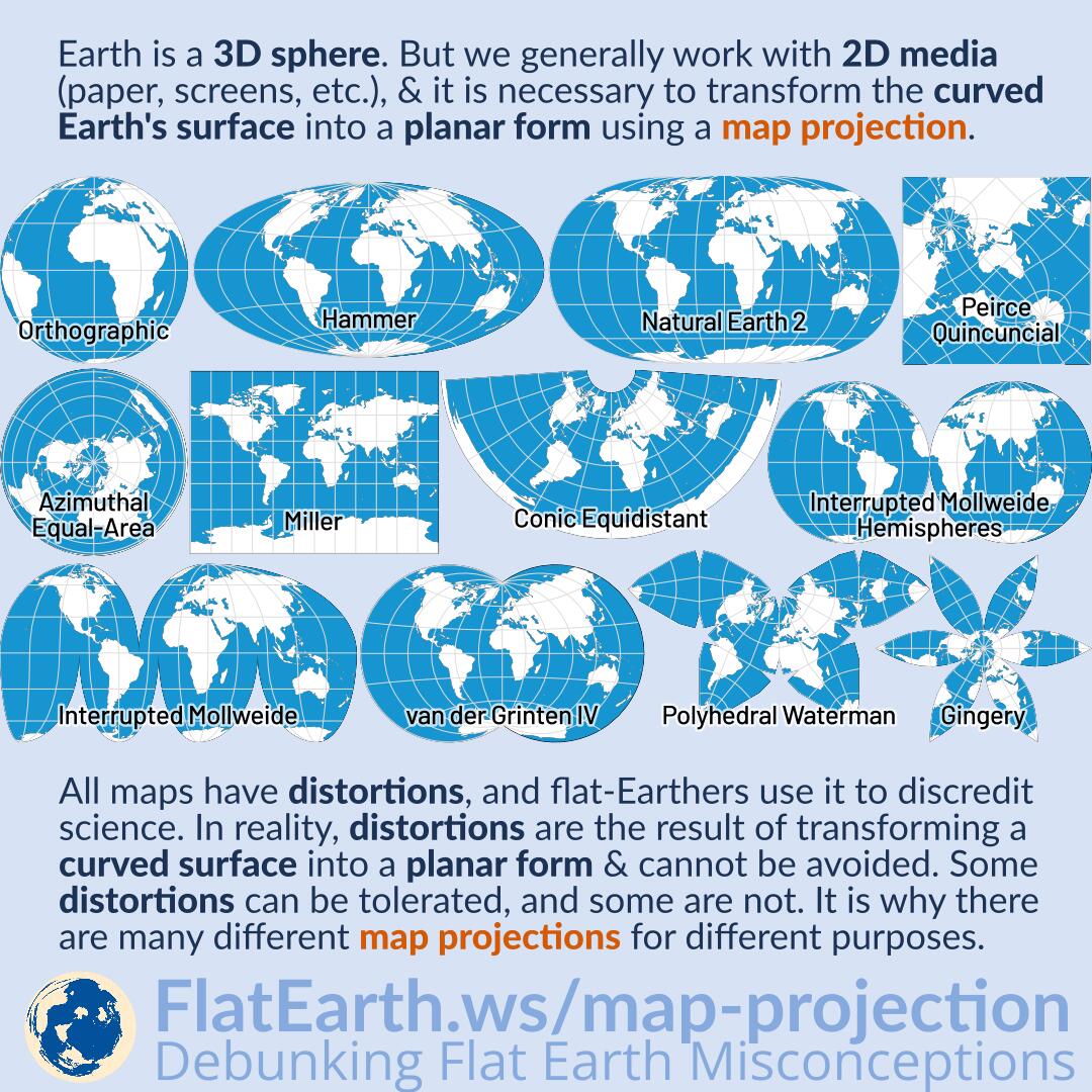
Earth is a sphere. But we generally work with two-dimensional media (paper, computer displays, televisions, phone screens, whiteboards, etc.), and it is necessary to transform the curved Earth’s surface into a planar form using a map projection.

All maps have distortions, and flat-Earthers use it to discredit science. In reality, distortions are the result of transforming a curved surface into a planar form & cannot be avoided. Some distortions can be tolerated, and some are not. It is why there are many different map projections for different purposes.

Continue reading “Map Projections and Distortions”

The Polar Azimuthal Equidistant Map is NOT the Flat Earth Map

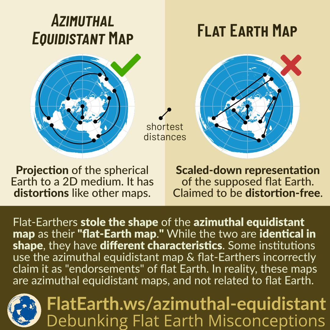
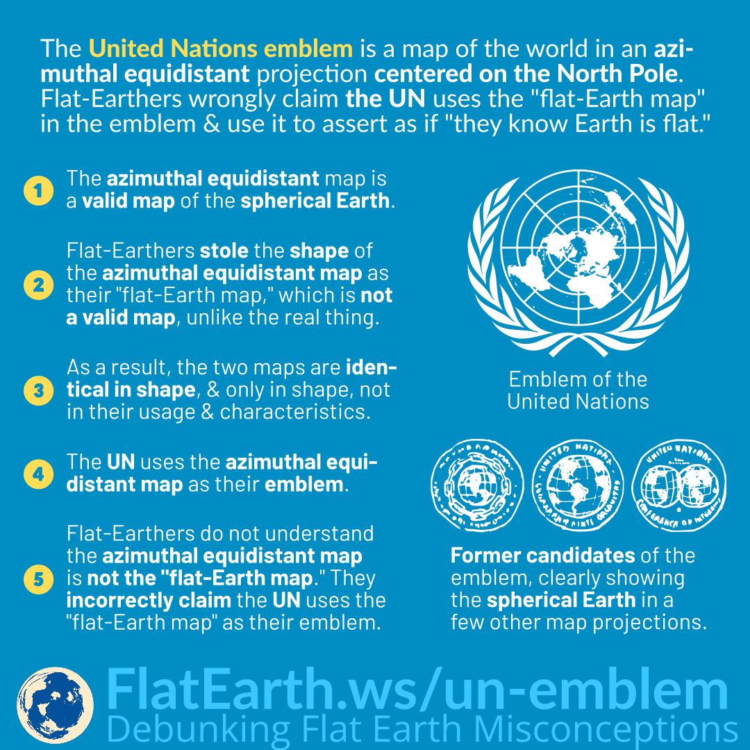
The azimuthal equidistant map is a projection of spherical Earth on a two-dimensional medium. The map has distortions, like every other type of map.

Flat-Earthers stole the shape of the azimuthal equidistant map and call it the “flat-Earth map.” While the two are identical in shape, they have different characteristics. The map that they call the “flat Earth map” is claimed to be a scaled-down representation of the supposed flat earth. They claim it to be distortion-free.

Some institutions use the azimuthal equidistant map & flat-Earthers incorrectly claim it as an “endorsement” of flat Earth. These maps are azimuthal equidistant maps and not related to flat Earth.

Continue reading “The Polar Azimuthal Equidistant Map is NOT the Flat Earth Map”

Gleason Map

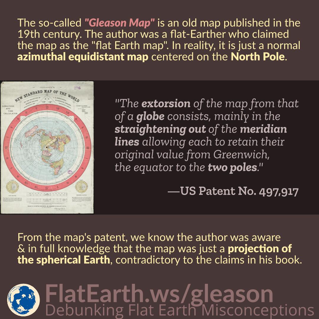
The so-called “Gleason Map” is an old map published in the 19th century. The author was a flat-Earther who claimed the map as the “flat Earth map.” In reality, the map is just a normal azimuthal equidistant map centered on the North Pole.

From the map’s patent, we know the author was aware and in full knowledge that the map was just a projection of the spherical Earth, contradictory to the claims in his book.

Continue reading “Gleason Map”

Blue Marble and the Visible Area of Earth’s Surface

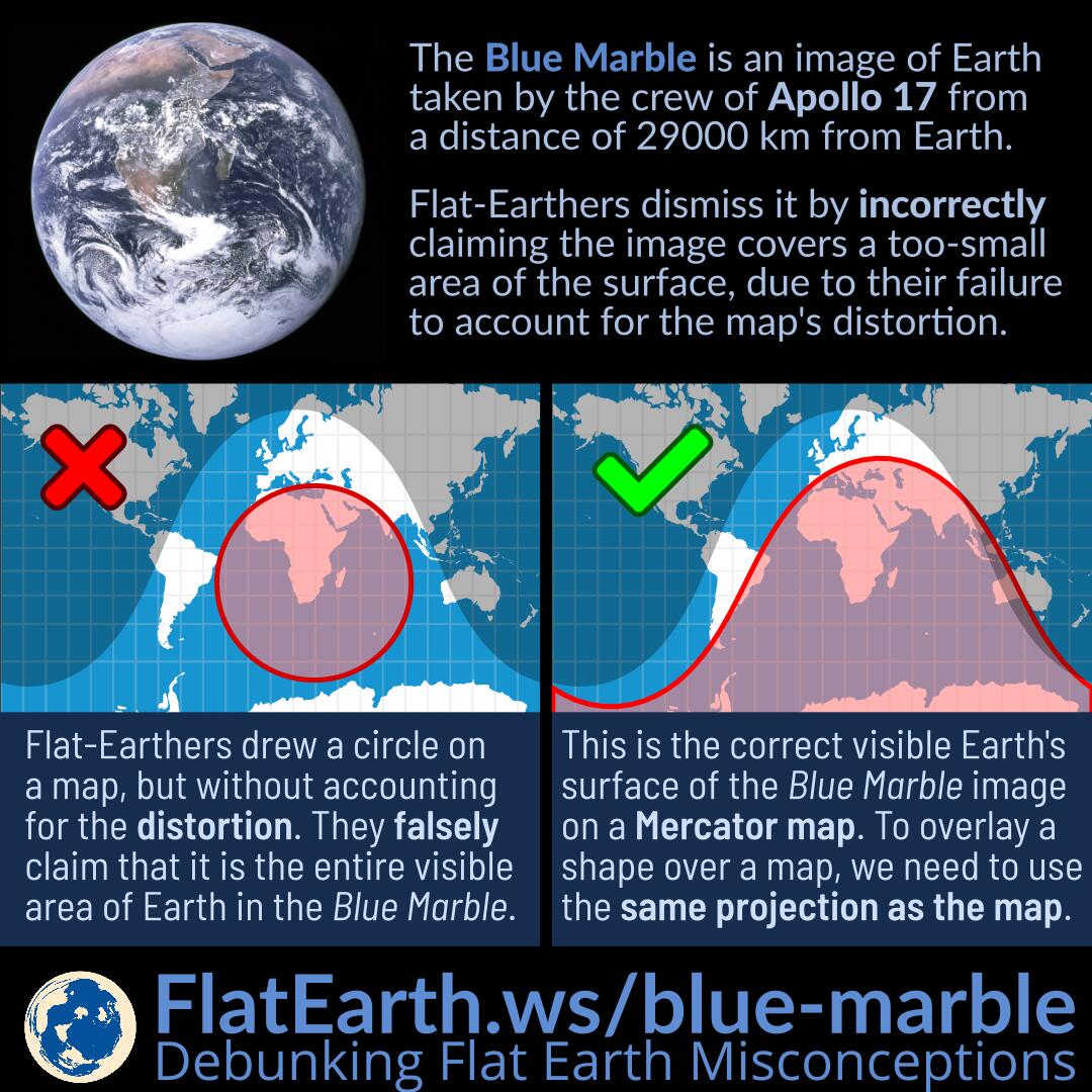
The Blue Marble is an image of Earth taken by the crew of the Apollo 17 spacecraft on its way to the Moon. It was taken from a distance of 29000 km from Earth’s surface.

Flat-Earthers dismiss it by incorrectly asserting that the image covers a too-small area of Earth’s surface, due to their failure to account for the maps’ distortion.

Continue reading “Blue Marble and the Visible Area of Earth’s Surface”

Psychological Projection

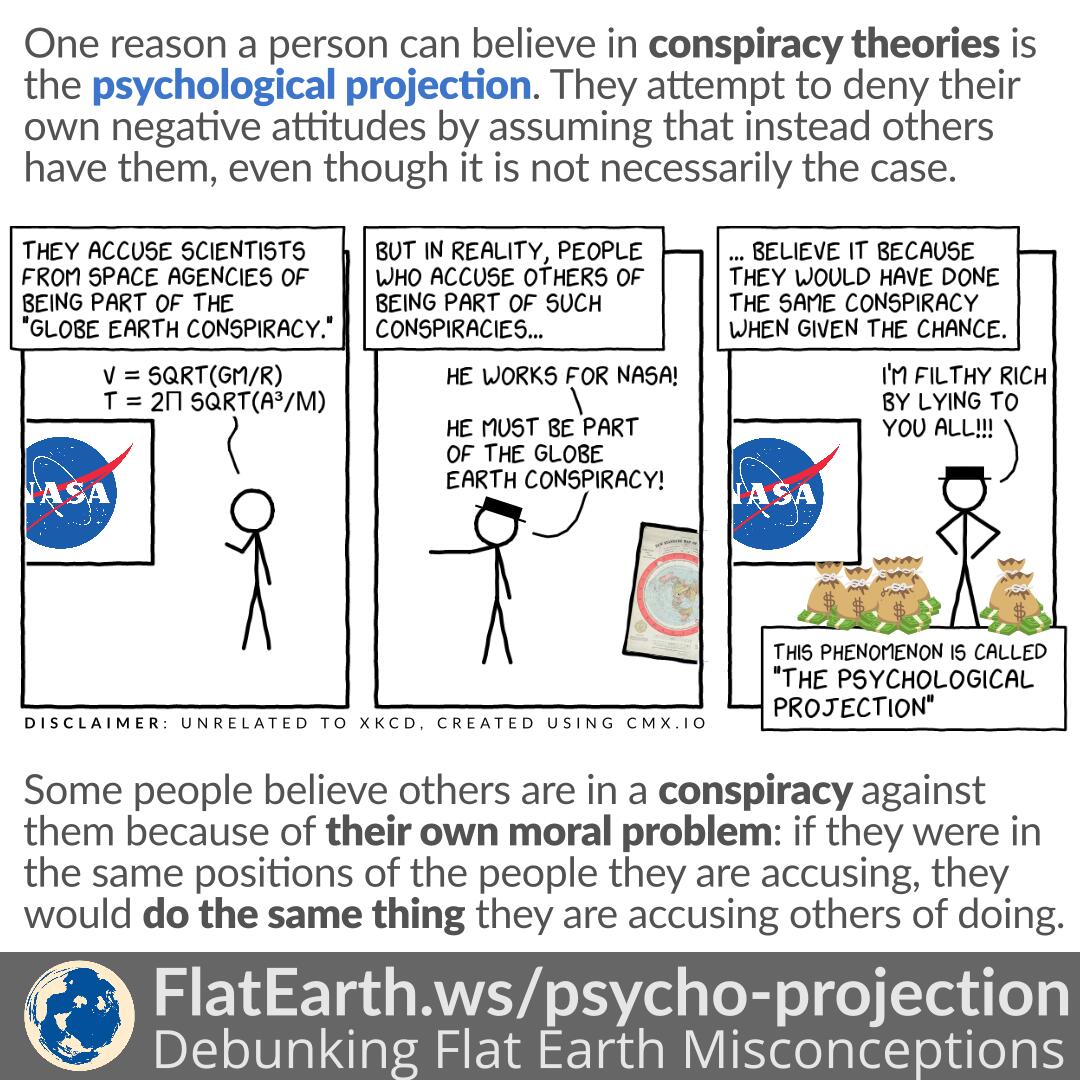
One reason a person can believe in conspiracy theories is the psychological projection. They attempt to deny their negative attitudes by assuming that instead, others have them, even though it is not necessarily the case.

Some people believe others are in a conspiracy against them because of their moral problem: if they were in the same positions of the people they are accusing, they would do the same thing they are accusing others of doing.

Continue reading “Psychological Projection”

Distortions of the Azimuthal Equidistant Map

Featured Video Play Icon

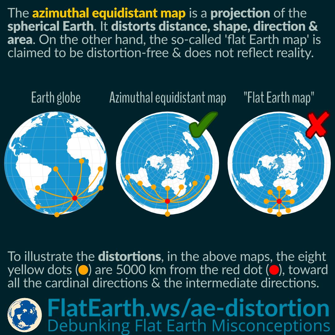
The azimuthal equidistant projection is a projection of the spherical Earth. As a result, a map using this projection has distortions in distances, shapes, directions, and areas. Just like the azimuthal equidistant map, all other types of maps have their distortion characteristics.

In the illustration, the eight yellow dots indicate a location 5000 km from the red dot, toward all the cardinal directions and the intermediate directions. We can see that the distances, shapes, directions, and areas are distorted in some way depending on the location on the map.

Continue reading “Distortions of the Azimuthal Equidistant Map”

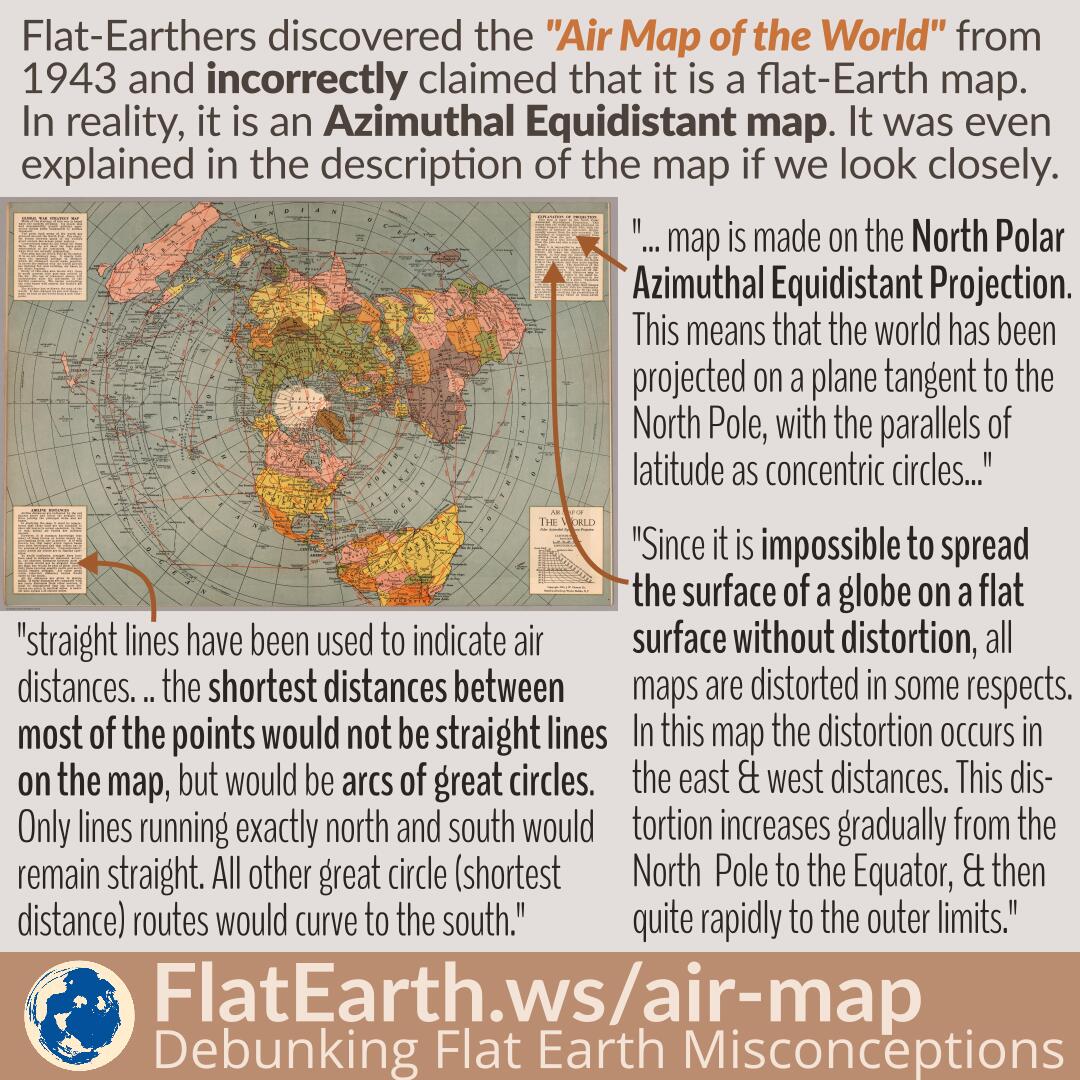
Air Map of the World 1943/1945

Flat-Earthers discovered a map titled “Air Map of the World” from 1943, explaining the flight routes during the time. Because the shape is identical to the fictional “flat Earth map,” they incorrectly claimed that it is a flat-Earth map. In reality, it is an azimuthal equidistant map that has distortions, a flattened shape of the spherical Earth on a flat surface, and does not depict the true shape of the Earth.

The exact nature of the map is even explained in a very detailed manner in the map’s description. Unfortunately, in the flat-Earth community, the map is passed around in a very low resolution, and therefore, the explanations become unreadable.

Continue reading “Air Map of the World 1943/1945”

Panorama Images and Horizon’s Curvature

A panorama image is stitched from multiple photos that were taken from different angles, forming a very wide field of view, even 360°×180°, covering every possible angle from the viewer.

Someone has taken a panorama from a high-altitude balloon and made available the results in various projections. Flat-Earthers saw a flat horizon in one of the panorama images and took the wrong conclusion. The horizon will appear flat in a cylindrical or equirectangular projection due to an effect of the projection. The panorama creator also has the panorama in other formats, including an interactive one in the general perspective projection, which shows how it would look from a human eye, and it shows the curvature.

Continue reading “Panorama Images and Horizon’s Curvature”