
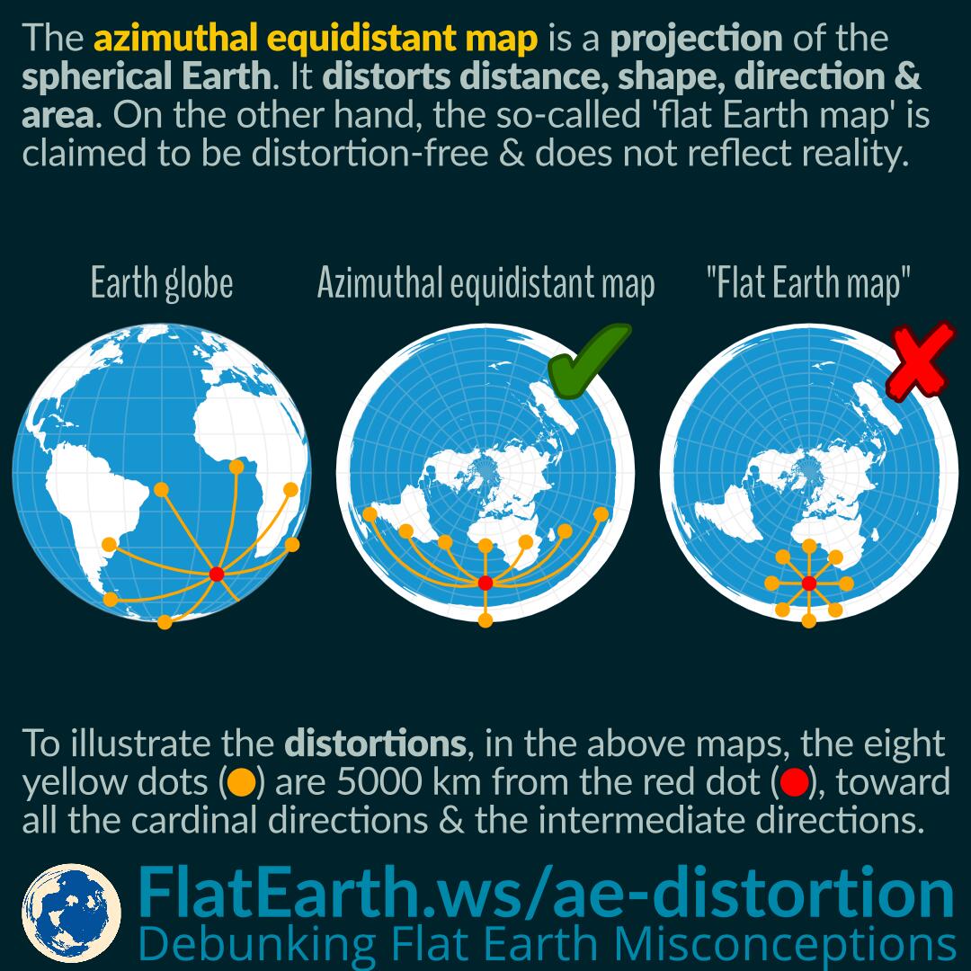

The azimuthal equidistant projection is a projection of the spherical Earth. As a result, a map using this projection has distortions in distances, shapes, directions, and areas. Just like the azimuthal equidistant map, all other types of maps have their distortion characteristics.
In the illustration, the eight yellow dots indicate a location 5000 km from the red dot, toward all the cardinal directions and the intermediate directions. We can see that the distances, shapes, directions, and areas are distorted in some way depending on the location on the map.
The “flat Earth map” has the same shape as the azimuthal equidistant map, but with a completely different characteristic. The so-called “flat Earth map” is claimed to be distortion-free, and as a result, it should have the same shape as the purported flat Earth, only with a different scale. In reality, the so-called “flat Earth map” cannot explain many real-world facts. On the other hand, the azimuthal equidistant map —even though it looks identical to the “flat Earth map”— can represent the real world, as long as we understand its distortion characteristics.
We can see that in the northern hemisphere, or the “center” of the map, the distortions are minimal, and the map looks and acts very similar to reality. Flat-Earthers often cherry-pick facts closer to the North Pole because the distortions are minimal, and they use it to show as if the so-called “flat Earth map” is somehow better than other types of map.
However, as we go south, the distortion increases quickly. And the assumption that the map is the distortion-free “flat-Earth map” becomes harder to defend. It is the reason that flat Earthers like to show us events that occurs in the north, but avoid mentioning anything closer to the “edge of the world.” As we approach the so-called “edge of the world,” the so-called “flat Earth map” quickly loses its explanatory power.
References
- Azimuthal equidistant projection – Wikipedia
- Map projection – Wikipedia