
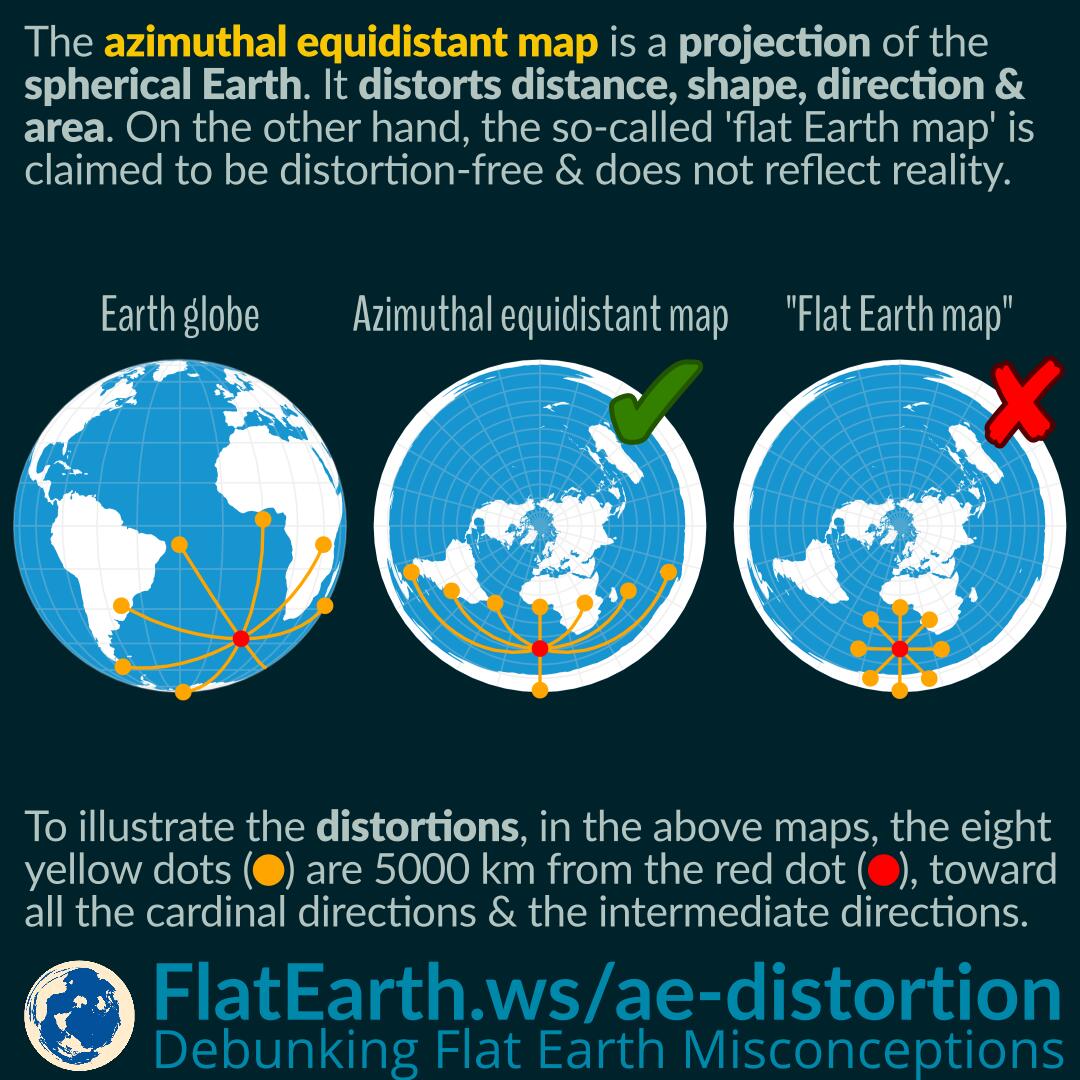

The azimuthal equidistant projection is a projection of the spherical Earth. As a result, a map using this projection has distortions in distances, shapes, directions, and areas. Just like the azimuthal equidistant map, all other types of maps have their distortion characteristics.
In the illustration, the eight yellow dots indicate a location 5000 km from the red dot, toward all the cardinal directions and the intermediate directions. We can see that the distances, shapes, directions, and areas are distorted in some way depending on the location on the map.
Continue reading “Distortions of the Azimuthal Equidistant Map”