
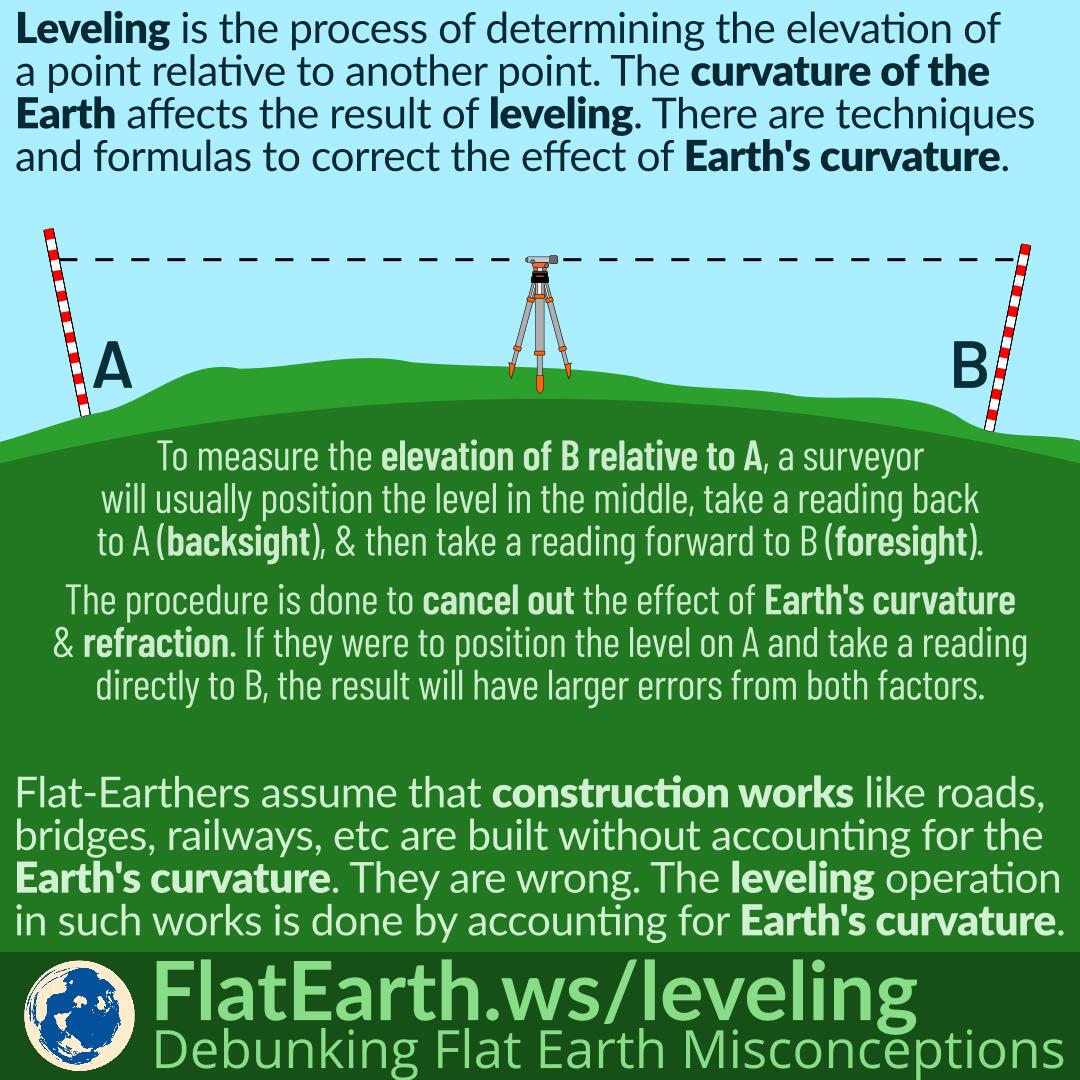
Leveling is the process of determining the elevation of a point relative to another point. The curvature of the Earth and atmospheric refraction affect the result of leveling. There are techniques and formulas to correct the effect of Earth’s curvature and atmospheric refraction.
Flat-Earthers assume that construction works like roads, bridges, railways, etc. are built without accounting for Earth’s curvature. They are wrong. The leveling in such works are done in such a way it minimizes the errors due to Earth’s curvature and atmospheric refraction.
To measure the elevation of point B relative to point A, a surveyor will usually position the level in the middle of the two points. Then they will take a reading back to A (backsight), and take a reading forward to B (foresight). From the two readings, the elevation difference between the two points can be calculated.
The procedure is done to cancel out the effect of Earth’s curvature and atmospheric refraction. If they were to position the level on A and take a reading directly to B, the result would have errors from both the Earth’s curvature and atmospheric refraction.
In construction works, they usually take chains of measurements. They would measure B relative to A, C relative to B, D relative to C, and so on. Without performing this procedure, the errors from previous readings will accumulate, and the last reading will contain the cumulative errors from all the previous readings.
References
- Simple Leveling: Backsight and Foresight – YouTube
- OTEN Building and Construction, Surveying Videos – YouTube
- Levelling – Wikipedia
- Curvature and Refraction in Surveying and Leveling Through History. Old Books, etc. – Metabunk
- Curvature and Refraction – AboutCivil.com