
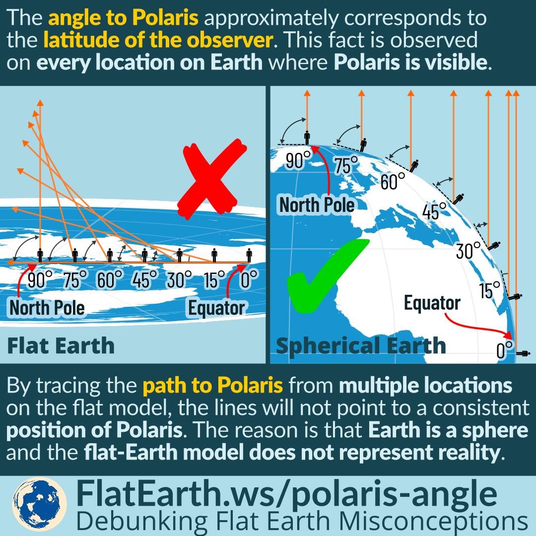
The angle (or altitude) to Polaris approximately corresponds to the latitude of the observer. This fact is observed on every location on Earth where Polaris is visible.
By tracing the path to Polaris from multiple locations on the flat Earth model, the lines will not point to a consistent position of Polaris. The reason is that the Earth is a sphere and the flat Earth model does not represent reality.
The position of Polaris today is conveniently very close to the north celestial pole. And therefore, the altitude or the angle between horizon and Polaris can be used to determine the approximate observer’s latitude.
South of the equator, Polaris is not visible and obviously cannot be used for navigation. Polaris is below the horizon and obstructed by the Earth. It is necessary to locate the south celestial pole in the sky to determine the observer’s latitude. It is more difficult as there is no bright star nearby, unlike Polaris in the north.
Polaris itself is not always the north star. Due to the Earth’s axial precession, the position of the north celestial pole will shift. Twenty centuries ago, the north celestial pole was closer to Kochab than Polaris.
All the observed facts are only possible if the Earth is a sphere, and impossible to happen if the Earth were flat.
References
- Polaris – Wikipedia
- Celestial pole – Wikipedia
- Celestial navigation – Wikipedia