Table of Contents
General Information
- Claimed by: FE Photographer
- Object 1:
- Name: Clark Island
- Distance: 19.59 mi (31.53 km)
- Elevation: 95 ft (29 m)
- Object 2:
- Name: Green Channel Marker Buoy
- Distance: 6.45 mi (10.38 km)
- Object 3:
- Name: Red Channel Marker Buoy
- Distance: 8.16 mi (13.13 km)
- Observer:
- Location: Bayview State Park
- Elevation: 17 ft (5.18 m)
Video
Simulation
Analysis
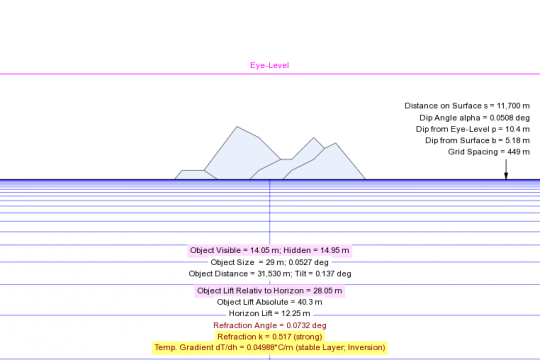
- The observer used Dizzib’s calculator which does not account for refraction.
- Even without accounting for tree heights, it is possible for the island to be visible if the atmospheric refraction is strong.
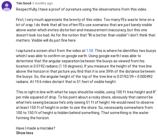
- A commenter determined the visible height by calculating the angular separation between the buoys. His conclusion is that 51 ft (15.54 m) of the island is visible, and the rest is obstructed.
- Everything is consistent with the globe Earth model.