Lake Pontchartrain’s Horizon Curvature

Featured Video Play Icon

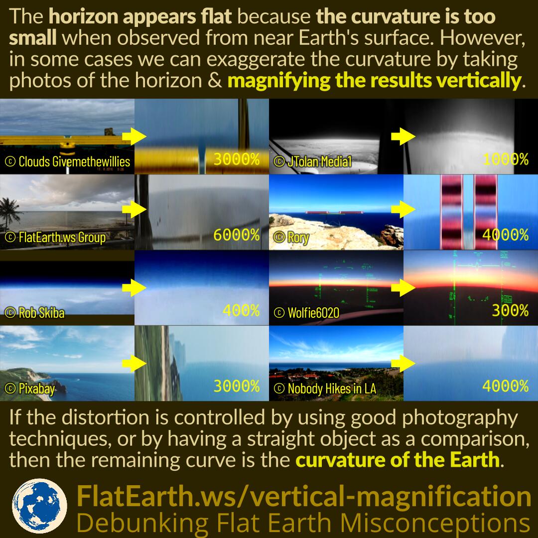
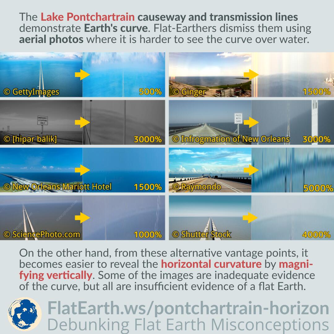
The Lake Pontchartrain causeway and transmission lines demonstrate Earth’s curvature. Flat-Earthers attempt to dismiss it using aerial photos where it is more difficult to see the curved landmarks over water.

On the other hand, from these alternative vantage points, it becomes easier to reveal the horizontal curvature by magnifying vertically. Because of the possibility of lens distortions, some of the images are inadequate evidence of the curve. However, all of them are insufficient evidence of a flat Earth.

Magnifying Images Vertically to Reveal Earth’s Curvature

Featured Video Play Icon

The horizon appears flat because the curvature is too small when observed from near the Earth’s surface. However, in some cases, we can exaggerate the curve by taking photographs of the horizon and then magnifying the results vertically.

Magnifying in such a way will also magnify the distortions introduced by the camera lens. We will need to control these distortions using proper photography techniques, or by placing a known straight object as a control object in the frame, close to the horizon. If successful, then the remaining curvature in the photograph can only come from the curvature of the Earth.

Continue reading “Magnifying Images Vertically to Reveal Earth’s Curvature”