Location Crowdsourcing

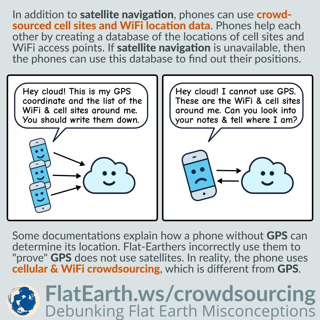
In addition to satellite navigation, mobile phones can also use crowdsourced cell sites and WiFi access points location data. Phones help each other by creating a centralized database of the locations of cell sites and WiFi access points. If satellite navigation is unavailable, then the phones can utilize this database to determine their positions.

Some documentations explain how a phone or device without GPS can determine its location. Flat-Earthers incorrectly use these documentations to “prove” GPS does not use satellites. In reality, there are various methods of determining location, not just GPS. These documentations explain location service using cell & WiFi crowdsourcing, which is different from GPS.

Continue reading “Location Crowdsourcing”

Google Maps Live Traffic and Simon Weckert’s Virtual Traffic Jam

Google Maps live traffic works by crowdsourcing. It determines the current traffic by aggregating information sent by many phones carried by many different traveling users.

In February 2020, artist Simon Weckert successfully gamed the system and faked a traffic jam in Google Maps. He did that by pulling a cart full of active phones and walking in the middle of roads. Google Maps system thought there were many slow-moving cars on the road and regarded that as a traffic jam. As a result, during Simon’s operation, an empty road appeared as dark red in Google Maps, as if a traffic jam was ongoing.

Flat-Earthers claimed that it proves that satellites do not exist; possibly because they did not know how the system works. It might be that they previously thought the traffic data was obtained directly from satellite imagery. In reality, satellite navigation systems, like the GPS, is very much involved in the system.

Continue reading “Google Maps Live Traffic and Simon Weckert’s Virtual Traffic Jam”