
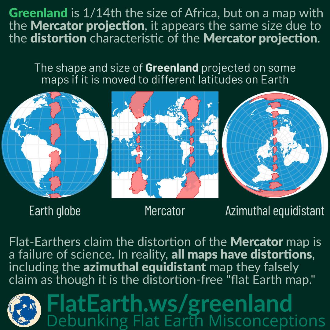

Greenland is 1/14th the size of Africa. However, in a map with the Mercator projection, it appears the same size due to the distortion characteristics of the Mercator projection.
Flat-Earthers claim the distortion of the Mercator map is a failure of science to describe the world. In reality, distortion is a consequence of flattening a 3D shape into flat 2D media. Distortion also occurs with the azimuthal equidistant map, which is claimed by flat-Earthers as the so-called “flat-Earth map.” All maps have distortions: it is incorrect to assume the azimuthal equidistant map is distortion-free.