Map Projections and Distortions

Featured Video Play Icon

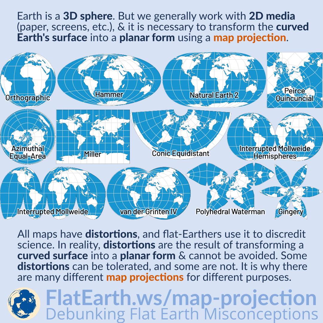
Earth is a sphere. But we generally work with two-dimensional media (paper, computer displays, televisions, phone screens, whiteboards, etc.), and it is necessary to transform the curved Earth’s surface into a planar form using a map projection.

All maps have distortions, and flat-Earthers use it to discredit science. In reality, distortions are the result of transforming a curved surface into a planar form & cannot be avoided. Some distortions can be tolerated, and some are not. It is why there are many different map projections for different purposes.

Continue reading “Map Projections and Distortions”

Gleason Map

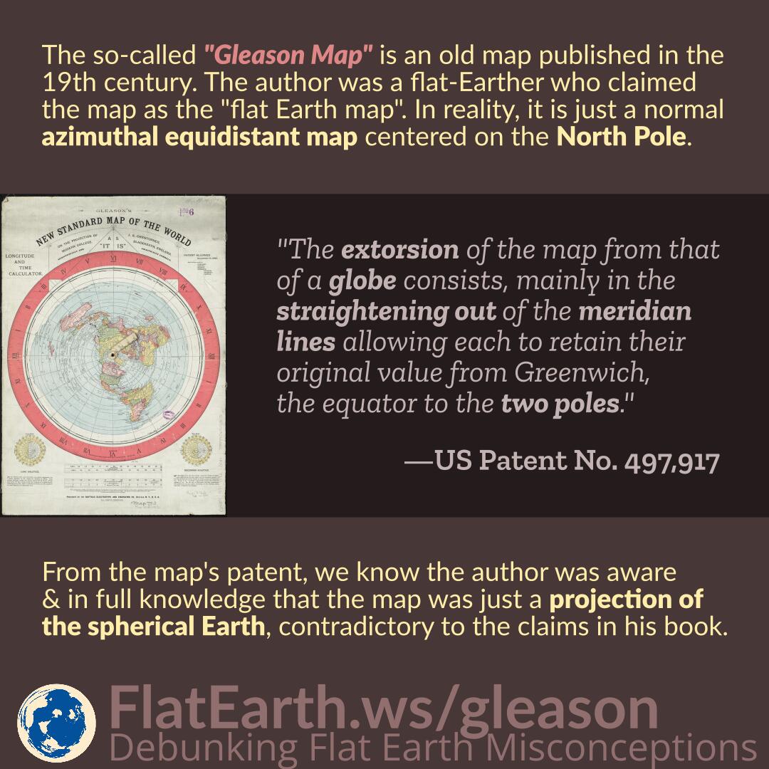
The so-called “Gleason Map” is an old map published in the 19th century. The author was a flat-Earther who claimed the map as the “flat Earth map.” In reality, the map is just a normal azimuthal equidistant map centered on the North Pole.

From the map’s patent, we know the author was aware and in full knowledge that the map was just a projection of the spherical Earth, contradictory to the claims in his book.

Continue reading “Gleason Map”

Air Map of the World 1943/1945

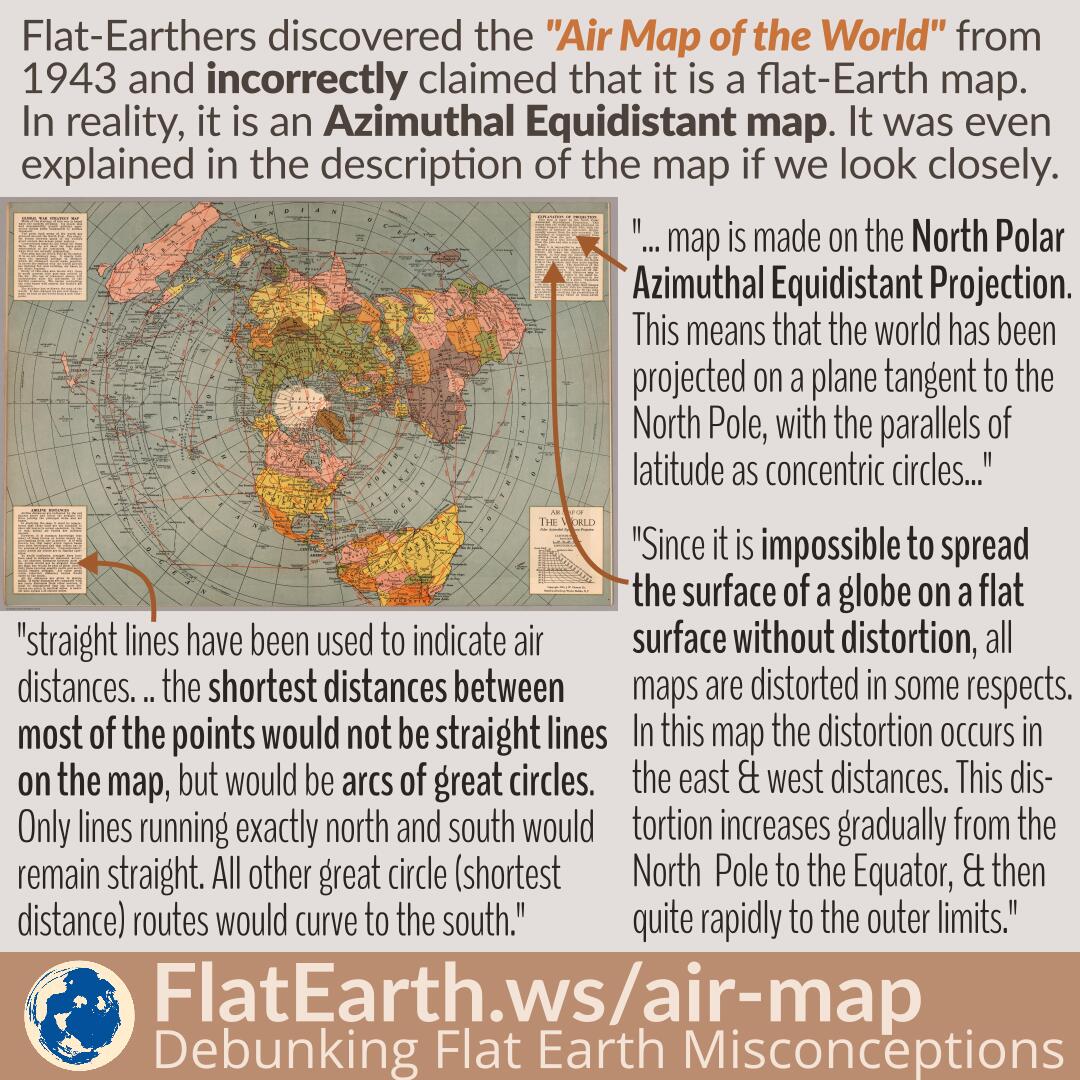
Flat-Earthers discovered a map titled “Air Map of the World” from 1943, explaining the flight routes during the time. Because the shape is identical to the fictional “flat Earth map,” they incorrectly claimed that it is a flat-Earth map. In reality, it is an azimuthal equidistant map that has distortions, a flattened shape of the spherical Earth on a flat surface, and does not depict the true shape of the Earth.

The exact nature of the map is even explained in a very detailed manner in the map’s description. Unfortunately, in the flat-Earth community, the map is passed around in a very low resolution, and therefore, the explanations become unreadable.

Continue reading “Air Map of the World 1943/1945”