
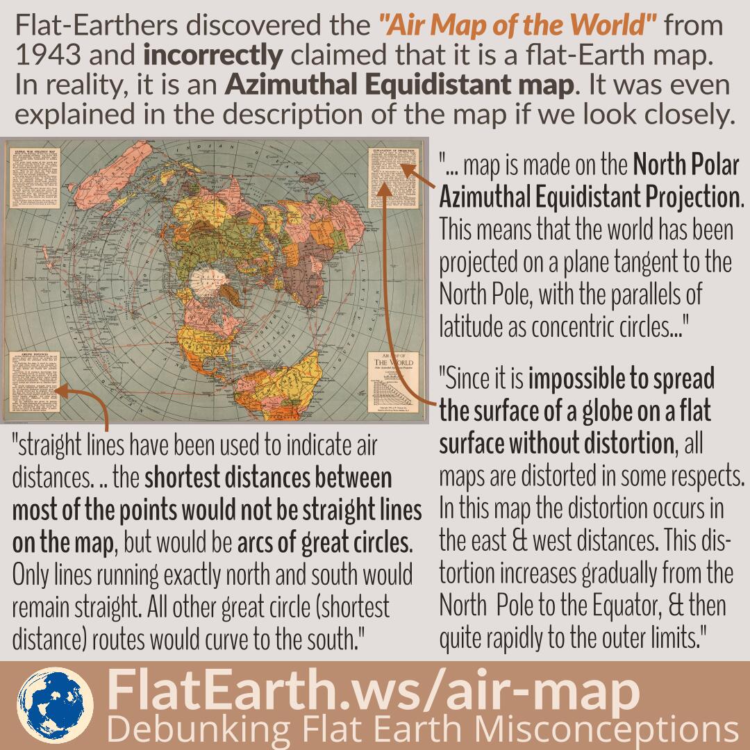
Flat-Earthers discovered a map titled “Air Map of the World” from 1943, explaining the flight routes during the time. Because the shape is identical to the fictional “flat Earth map,” they incorrectly claimed that it is a flat-Earth map. In reality, it is an azimuthal equidistant map that has distortions, a flattened shape of the spherical Earth on a flat surface, and does not depict the true shape of the Earth.
The exact nature of the map is even explained in a very detailed manner in the map’s description. Unfortunately, in the flat-Earth community, the map is passed around in a very low resolution, and therefore, the explanations become unreadable.