
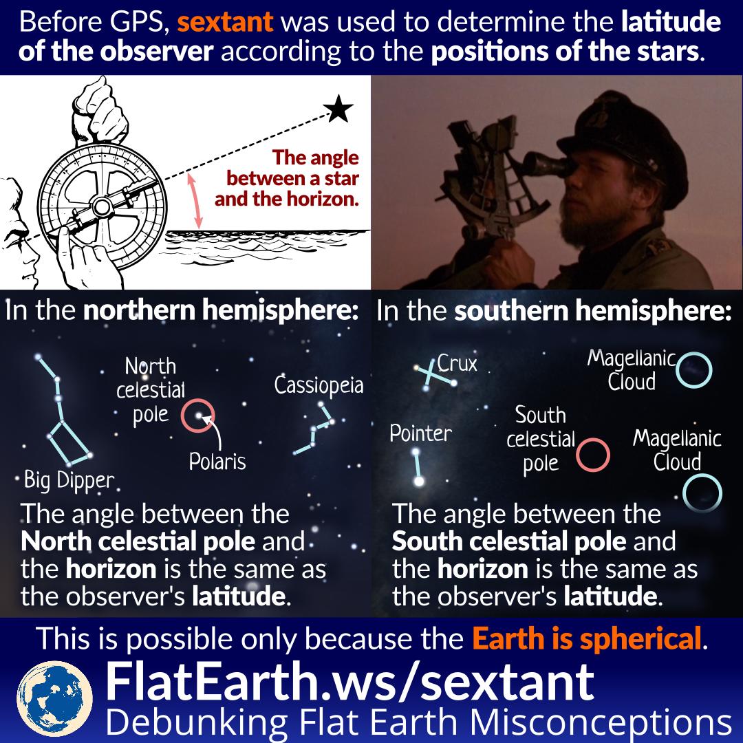
Long before GPS, navigators used a device called ‘sextant’ to determine the angle of a celestial body. From that data, the latitude of their current location can be determined.
This can only happen if the Earth is spherical.
In the Northern hemisphere, navigators usually used Polaris. Using a sextant, they measured the angle between Polaris and the horizon. The angle would be very close to the latitude of their current position.
In the Southern hemisphere, they did the same thing but with the south celestial pole. The problem is that there’s no bright star close to the south celestial pole, unlike Polaris in the North. So, they used the nearby Crux and Pointer stars to determine the approximate location of the south celestial pole. The angle between the south celestial pole and the horizon is the same as the latitude of the observer.
In the Northern hemisphere, the southern celestial pole is not visible. And conversely, in the Southern hemisphere, Polaris is not visible. So, there’s no ambiguity on which star to aim.
Celestial navigation is possible only because the Earth is spherical. We make use of the knowledge of the correct figure of the Earth for the purposes of navigation. This is how our ancestors were able to travel to the other side of the world (and back to the original location) without the modern technology we have today.
References
- Sextant – Wikipedia
- Celestial navigation – Wikipedia