
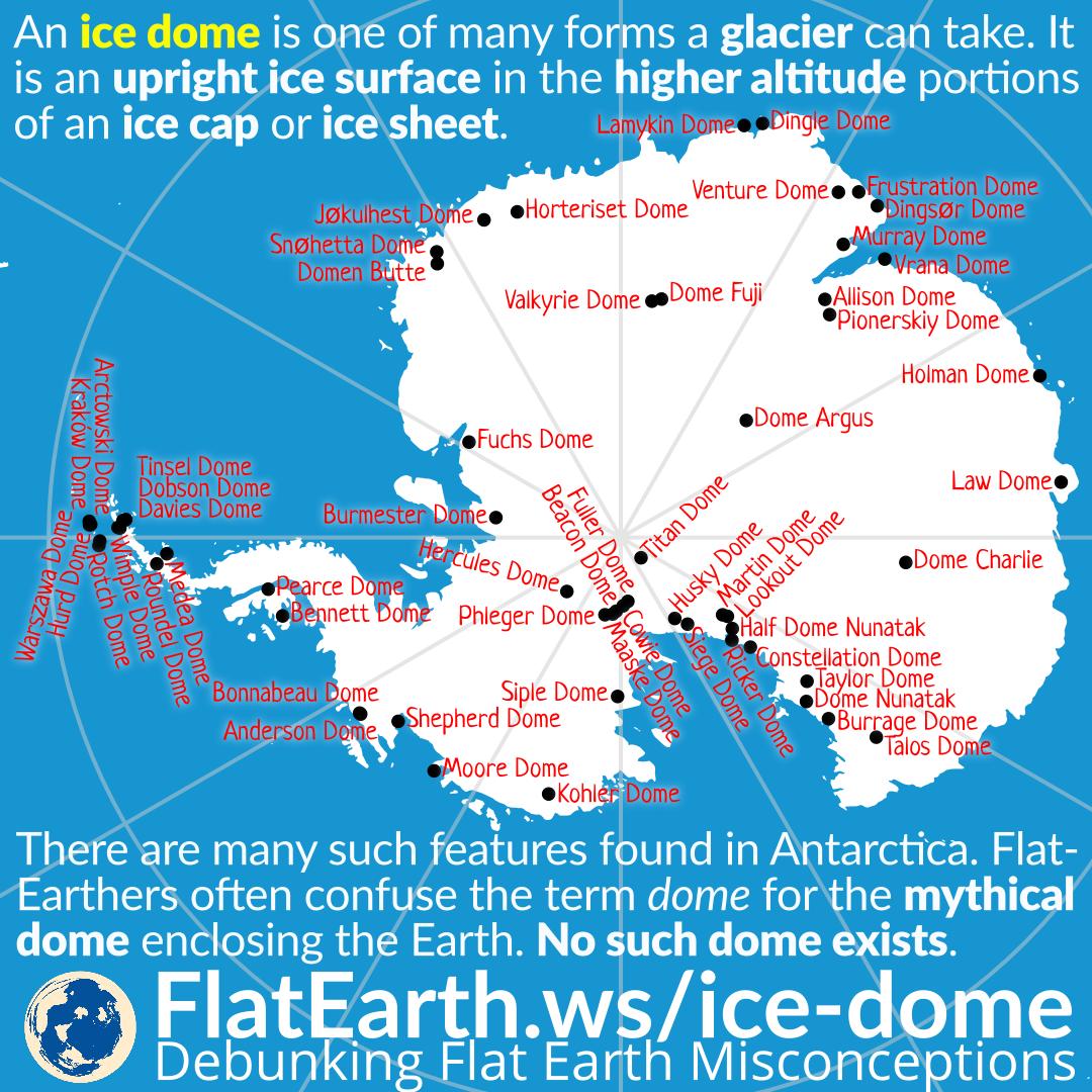
An ice dome is one of many forms a glacier can take. It is an upright ice surface in the higher altitude portions of an ice cap or an ice sheet. There are many such features found on icy terrain. And Antarctica is no exception.
When an ice dome gets mentioned, flat-Earthers often confuse it with the mythical dome enclosing the Earth as described in most flat Earth model. No such dome actually exists.
For example, an ice dome was mentioned in the 1958 Encyclopedia Americana:
These flights proved the inland areas to be featureless in character, with a dome 13,000 feet high at about latitude 80°S, longitude 90°E.
Some flat-Earthers present this as ‘evidence’ of the mythical ‘dome’ enclosing the Earth. They are wrong. The ‘dome’ here obviously refers to an ice dome.
Another ‘dome’ was mentioned in the paper ‘Antarctica in the International Geophysical Year, Issue 1’:
The latter is believed to be a massive Precambrian shield superimposed by a great dome of snow and ice, and toward its center reaching in excess of 13,000 feet elevation.
Again, it is simply another ice dome, not the dome they want it to be.
Map in Illustration
The map of the Antarctic domes used in our illustration is generated from Antarctica Features database from USGS. We took all the entries that have the word ‘dome’ under the description, converted them to a JSON file, then plotted them on a map of Antarctica using the D3.js Javascript library. Later, we imported the resulting SVG to Inkscape for enhancements and finishing using our standard workflow.
Reference
- BGN: Domestic and Antarctic Names – USGS
- Ice domes – Glacier morphology – Wikipedia
- 1958 Encyclopedia Americana quote “[Antarctic] DOME 13,000 feet high” / Admiral Byrd quote – Flat Earth Insanity
- Antarctica in the International Geophysical Year, Issue 1 – American Geophysical Union