flatearth.ws
Overlay in Geographic Information System (GIS)
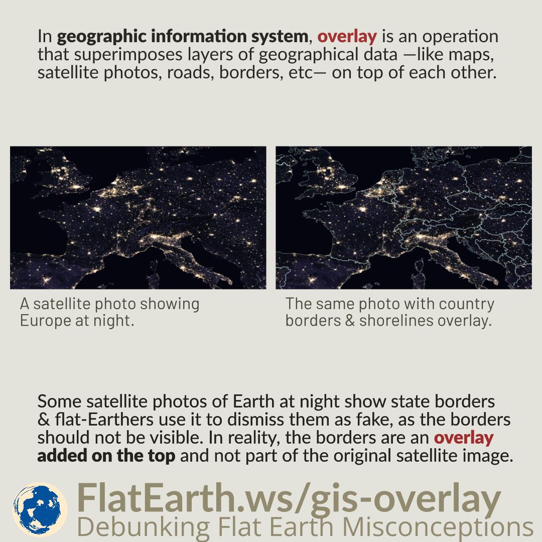
In geographic information system (GIS), overlay is an operation that superimposes layers of geographical data —like maps, satellite photos, roads, borders, etc— on top of each other. Some satellite…