
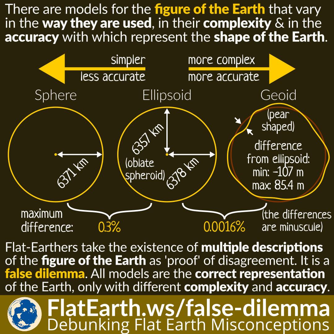
There are several models explaining the figure of the Earth. These models vary in the way they are used, in their complexity and in the accuracy with which they represent the size and shape of the Earth. These models are sphere, ellipsoid, and geoid.
Flat-Earthers often take the existence of these multiple models as evidence of disagreement among scientists, and that the shape of the Earth is still in contention. They are wrong. All these models are valid models, only with different complexity and accuracy.
The list of the models describing the figure of the Earth:
- Sphere: the Earth is a sphere with the radius of 6371 km.
- Ellipsoid: the Earth is an oblate spheroid with the radius of 6357 km at the poles and 6378 km at the equator.
- Geoid: an irregular surface of the Earth, that have the same potential under the influence of Earth’s gravity and rotation.
The sphere model is the simplest. It is not ‘wrong’, but not as accurate as the other models. The geoid model is the most accurate, but also the most complex. The ellipsoid model is between the two in terms of complexity and accuracy.
All the models are the correct representation of the Earth. We choose a model based on our requirements. The Google Maps application, for example, uses the sphere model because it is simpler and requires less processing power; and thus usable on many devices, including low-end ones. It would save battery power, and taking account of its many users, would also save a substantial amount of energy.
On the other hand, to determine the elevation of a location, we use the far more accurate geoid model. The term ‘above sea level’ actually means that the elevation is measured from the geoid surface, which is the sea level at that location if it were an ocean.
Taking the many models of the figure of the Earth as evidence of disagreement is a fallacy of false dilemma. In reality, there’s no such dilemma.
References
- Web Mercator – Wikipedia
- Figure of the Earth – Wikipedia
- False Dilemma – Logically Fallacious
- False dilemma – Wikipedia