
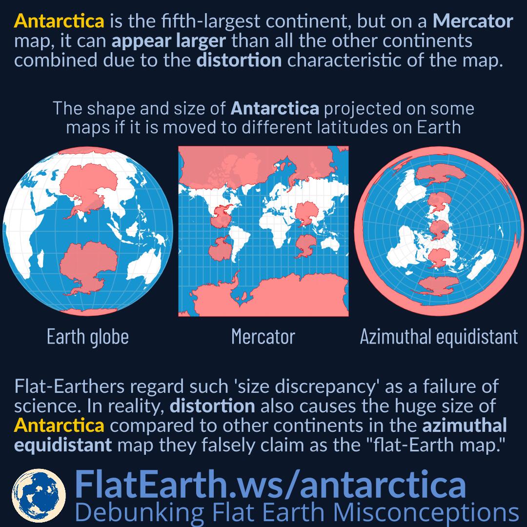

Antarctica is the fifth-largest continent, but on a Mercator map, it can appear larger than all the other continents combined due to the map’s distortion characteristic.
Flat-Earthers regard such “size discrepancy” as a failure of science to describe the world. In reality, map distortion also causes Antarctica’s huge size compared to other continents in the azimuthal equidistant map which they falsely claim as the so-called “flat-Earth map”.
In the azimuthal equidistant map centered on the North Pole, Antarctica appears on the edge of the map because it lies on the antipodal point of the map’s center, which is the North Pole. The distortion characteristics of the map make it so, not because it is the real shape of Antarctica.
References
- Mercator projection – Wikipedia
- Azimuthal equidistant projection – Wikipedia